Real-Time Dam Levels
Across Australia

Track water storage, capacity and historical trends for major reservoirs in New South Wales, Victoria, Queensland and beyond.

57.7% National average
303 Dams tracked
87,729 GL Total capacity
04 Jun 2026 Last Updated
Tantangara Reservoir Water Level

Tantangara Reservoir Water Level

New South Wales · Unknown
Reviewed by Water Resources Analyst
Hydrological Summary: Tantangara Reservoir currently stores 7.2% of its total 254 GL capacity. Located in NSW and operated by Snowy Hydro Limited, it is a critical water source for regional supply and irrigation.
Data officially sourced and updated from New South Wales water authorities. Last dataset update: 2026-06-02 02:10:00
Current Storage Level 7.2%
Total Capacity
254 GL
Status
Normal / Safe
Operator
Snowy Hydro Limited
Last Updated
02 Jun 2026
Live Weather
2°C Partly cloudy
Rain: 0mm | Hum: 92%

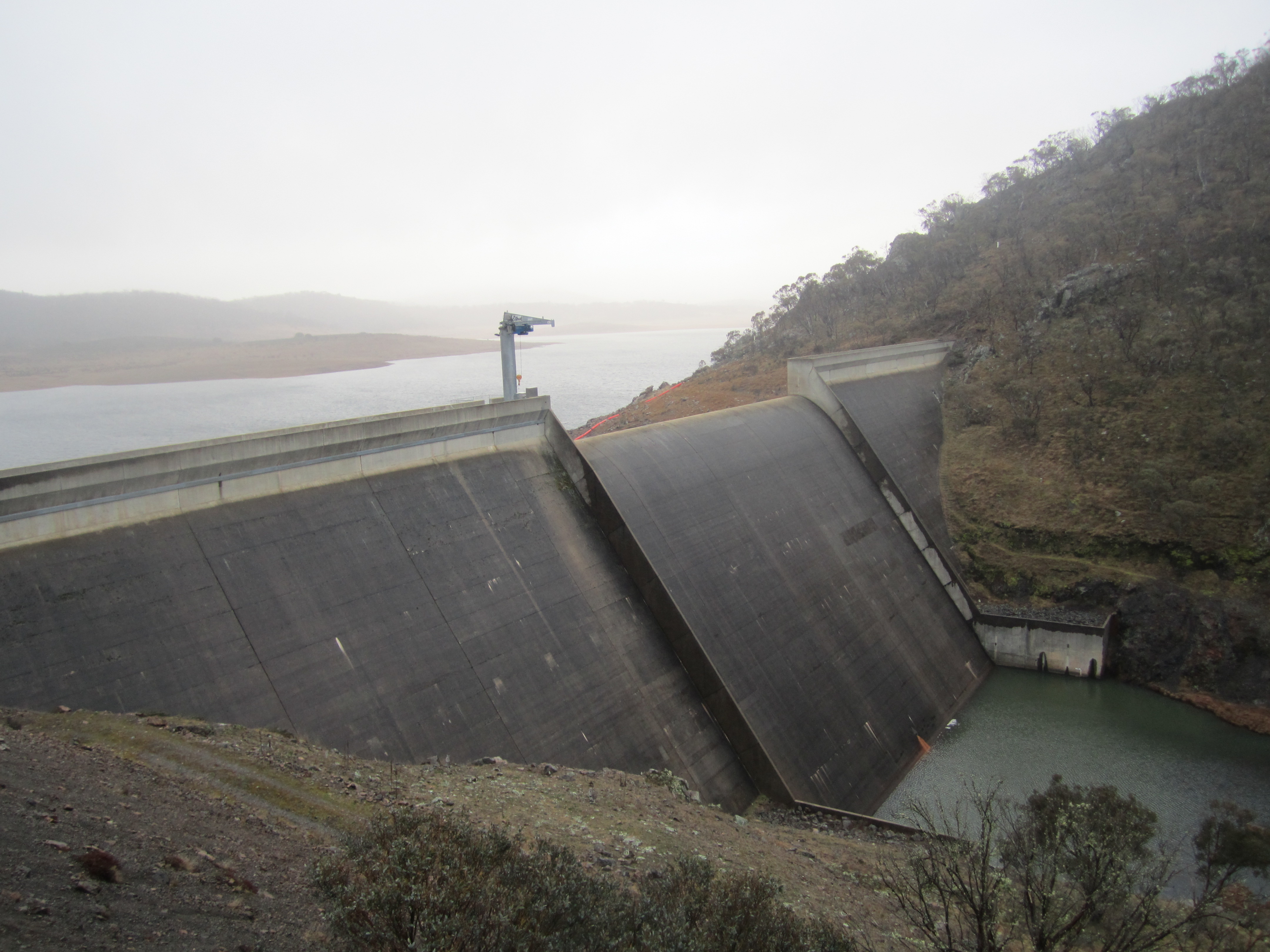
Water Level Analysis

Reservoir storage at Tantangara Reservoir has reached critically low levels. Sitting at a mere 7.2% of its 254 GL total capacity, extreme conservation measures may be required. This critical shortage heavily impacts regional water security across New South Wales.

Catchment & Hydrological Impact

The Murrumbidgee River acts as the primary lifeblood for Tantangara Reservoir, making it a cornerstone of the Murray-Darling Basin network. Managing the flow from the Murrumbidgee River ensures that downstream agricultural zones receive consistent supply. Catchment dynamics in the Murray-Darling Basin are deeply influenced by the retention capacity of Tantangara Reservoir.

Agricultural & Economic Significance

Agriculture in the surrounding areas of New South Wales depends heavily on the water security provided by Tantangara Reservoir. Irrigation allocations are directly tied to these storage metrics. Sustainable water management here ensures that both crops and livestock can survive prolonged dry spells.

Ecological & Recreational Context

The surrounding catchment of Tantangara Reservoir also supports diverse local flora and fauna. During periods of healthy water levels, the area often sees an increase in recreational activities such as fishing, boating, and camping. Authorities must constantly balance the need for human water consumption with the ecological necessity of maintaining healthy river systems downstream.

Current Weather & Evaporation Impact

With a mild reading of 2°C today, surface evaporation is significantly reduced, helping to preserve current volume. Under current partly cloudy weather, there is no direct rainfall contributing to the immediate storage levels.

Future Outlook & Monitoring

Looking ahead, the trajectory of Tantangara Reservoir's water levels will depend heavily on upcoming seasonal rainfall patterns. State water authorities utilize highly sophisticated monitoring tools to ensure every drop is accounted for. Resilience against extreme weather events remains the ultimate goal for the managers of this critical infrastructure.

Location Map

Frequently Asked Questions

What is the current water level of Tantangara Reservoir?
As of the latest official reading, the water level at Tantangara Reservoir is at 7.2% of its total capacity.
Is Tantangara Reservoir currently full?
No, it is currently experiencing low water levels at 7.2%.
What is the maximum water capacity of Tantangara Reservoir?
When completely full (100%), Tantangara Reservoir can hold up to 254 Gigalitres (GL) of water.
Where is Tantangara Reservoir located?
This reservoir is a critical water storage facility located in the state of New South Wales, Australia.
How does the water level at Tantangara Reservoir affect local agriculture?
Water levels dictate the irrigation allocations for surrounding farmlands. A healthy level of 7.2% ensures that local farmers have the necessary water security for their seasonal crops and livestock.
Who manages the data for Tantangara Reservoir?
The data is sourced from official government authorities including the Bureau of Meteorology (BOM) and specific state water utilities.

Nearby Dams in New South Wales

Largest Reservoirs in New South Wales

Latest Water & Drought News

← Back to all dams