Real-Time Dam Levels
Across Australia

Track water storage, capacity and historical trends for major reservoirs in New South Wales, Victoria, Queensland and beyond.

57.7% National average
303 Dams tracked
87,729 GL Total capacity
04 Jun 2026 Last Updated
Mount Bold Water Level

Mount Bold Water Level

South Australia · Adelaide
Reviewed by Water Resources Analyst
Hydrological Summary: Mount Bold currently stores 31.2% of its total 46 GL capacity. Located in SA and operated by SA Water, it is a critical water source for regional supply and irrigation.
Data officially sourced and updated from South Australia water authorities. Last dataset update: 2026-05-31 00:30:00
Current Storage Level 31.2%
Total Capacity
46 GL
Status
Normal / Safe
Operator
SA Water
Last Updated
31 May 2026
Live Weather
11°C Partly cloudy
Rain: 0mm | Hum: 75%

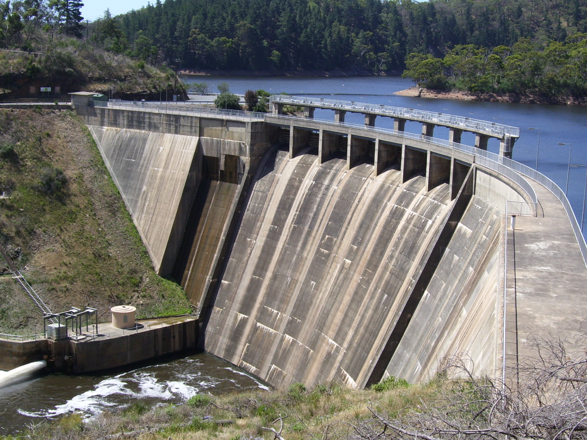
Water Level Analysis

The current volume at Mount Bold is running lower than standard operational thresholds. At 31.2%, the facility only holds 46 GL. This lower-than-average capacity may trigger preliminary water-saving advisories in South Australia if dry conditions persist.

Catchment & Hydrological Impact

The Onkaparinga River acts as the primary lifeblood for Mount Bold, making it a cornerstone of the South Australian Gulf network. Managing the flow from the Onkaparinga River ensures that downstream agricultural zones receive consistent supply. The South Australian Gulf region relies heavily on the seasonal inflows captured here.

Agricultural & Economic Significance

Beyond standard municipal supply, Mount Bold is a vital asset for the regional agricultural economy in South Australia. Irrigation allocations are directly tied to these storage metrics. Sustainable water management here ensures that both crops and livestock can survive prolonged dry spells.

Ecological & Recreational Context

The surrounding catchment of Mount Bold also supports diverse local flora and fauna. During periods of healthy water levels, the area often sees an increase in recreational activities such as fishing, boating, and camping. Authorities must constantly balance the need for human water consumption with the ecological necessity of maintaining healthy river systems downstream.

Current Weather & Evaporation Impact

Cooler current temperatures of 11°C help minimize evaporation losses across the reservoir. Under current partly cloudy weather, there is no direct rainfall contributing to the immediate storage levels.

Future Outlook & Monitoring

Looking ahead, the trajectory of Mount Bold's water levels will depend heavily on upcoming seasonal rainfall patterns. State water authorities utilize highly sophisticated monitoring tools to ensure every drop is accounted for. Resilience against extreme weather events remains the ultimate goal for the managers of this critical infrastructure.

Location Map

Frequently Asked Questions

What is the current water level of Mount Bold?
As of the latest official reading, the water level at Mount Bold is at 31.2% of its total capacity.
Is Mount Bold currently full?
No, it is currently experiencing low water levels at 31.2%.
What is the maximum water capacity of Mount Bold?
When completely full (100%), Mount Bold can hold up to 46 Gigalitres (GL) of water.
Where is Mount Bold located?
This reservoir is a critical water storage facility located in the state of South Australia, Australia.
How does the water level at Mount Bold affect local agriculture?
Water levels dictate the irrigation allocations for surrounding farmlands. A healthy level of 31.2% ensures that local farmers have the necessary water security for their seasonal crops and livestock.
Who manages the data for Mount Bold?
The data is sourced from official government authorities including the Bureau of Meteorology (BOM) and specific state water utilities.

Nearby Dams in South Australia

Largest Reservoirs in South Australia

Latest Water & Drought News

← Back to all dams