Real-Time Dam Levels
Across Australia

Track water storage, capacity and historical trends for major reservoirs in New South Wales, Victoria, Queensland and beyond.

57.7% National average
303 Dams tracked
87,729 GL Total capacity
04 Jun 2026 Last Updated
Upper Stony Creek No. 2 Water Level

Upper Stony Creek No. 2 Water Level

Victoria · Unknown
Reviewed by Water Resources Analyst
Hydrological Summary: Upper Stony Creek No. 2 currently stores 19% of its total 2 GL capacity. Located in VIC and operated by Barwon Water, it is a critical water source for regional supply and irrigation.
Data officially sourced and updated from Victoria water authorities. Last dataset update: 2026-06-02 00:00:00
Current Storage Level 19%
Total Capacity
2 GL
Status
Normal / Safe
Operator
Barwon Water
Last Updated
02 Jun 2026
Live Weather
9°C Raining
Rain: 0.2mm | Hum: 95%

Water Level Analysis
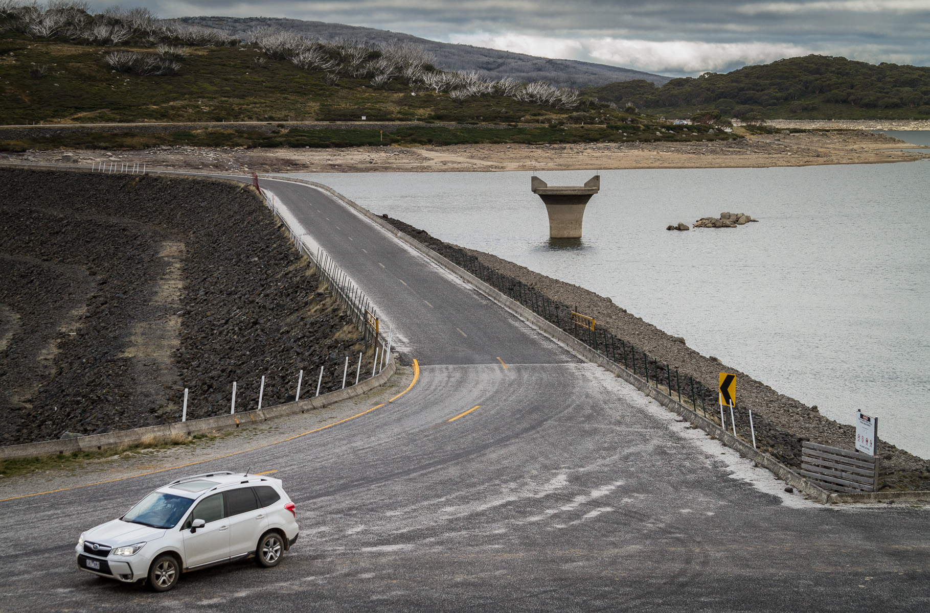
Reservoir storage at Upper Stony Creek No. 2 has reached critically low levels. Sitting at a mere 19% of its 2 GL total capacity, extreme conservation measures may be required. Extended drought conditions or lack of significant inflows into the catchment are likely the primary drivers of this severe depletion.

Catchment & Hydrological Impact

Fed primarily by the Upper Stony Creek, this reservoir plays a critical role in the South East Coast (Victoria) drainage division. Managing the flow from the Upper Stony Creek ensures that downstream agricultural zones receive consistent supply. Catchment dynamics in the South East Coast (Victoria) are deeply influenced by the retention capacity of Upper Stony Creek No. 2.

Agricultural & Economic Significance

Beyond standard municipal supply, Upper Stony Creek No. 2 is a vital asset for the regional agricultural economy in Victoria. Irrigation allocations are directly tied to these storage metrics. Without the buffer provided by this massive 2 GL storage, regional farming would face extreme volatility.

Ecological & Recreational Context

Ecologically, the reservoir and its immediate wetlands serve as a crucial habitat for native Australian wildlife. When capacity allows, Upper Stony Creek No. 2 becomes a hub for regional tourism and water sports. However, environmental flow releases must be carefully balanced to protect downstream river health.

Current Weather & Evaporation Impact

With a mild reading of 9°C today, surface evaporation is significantly reduced, helping to preserve current volume. The recorded precipitation of 0.2mm indicates active rainfall in the catchment, which is excellent news for inflows.

Future Outlook & Monitoring

Looking ahead, the trajectory of Upper Stony Creek No. 2's water levels will depend heavily on upcoming seasonal rainfall patterns. State water authorities utilize highly sophisticated monitoring tools to ensure every drop is accounted for. Resilience against extreme weather events remains the ultimate goal for the managers of this critical infrastructure.

Location Map

Frequently Asked Questions

What is the current water level of Upper Stony Creek No. 2?
As of the latest official reading, the water level at Upper Stony Creek No. 2 is at 19% of its total capacity.
Is Upper Stony Creek No. 2 currently full?
No, it is currently experiencing low water levels at 19%.
What is the maximum water capacity of Upper Stony Creek No. 2?
When completely full (100%), Upper Stony Creek No. 2 can hold up to 2 Gigalitres (GL) of water.
Where is Upper Stony Creek No. 2 located?
This reservoir is a critical water storage facility located in the state of Victoria, Australia.
How does the water level at Upper Stony Creek No. 2 affect local agriculture?
Water levels dictate the irrigation allocations for surrounding farmlands. A healthy level of 19% ensures that local farmers have the necessary water security for their seasonal crops and livestock.
Who manages the data for Upper Stony Creek No. 2?
The data is sourced from official government authorities including the Bureau of Meteorology (BOM) and specific state water utilities.

Nearby Dams in Victoria

Largest Reservoirs in Victoria

Latest Water & Drought News

← Back to all dams