Water Level Analysis
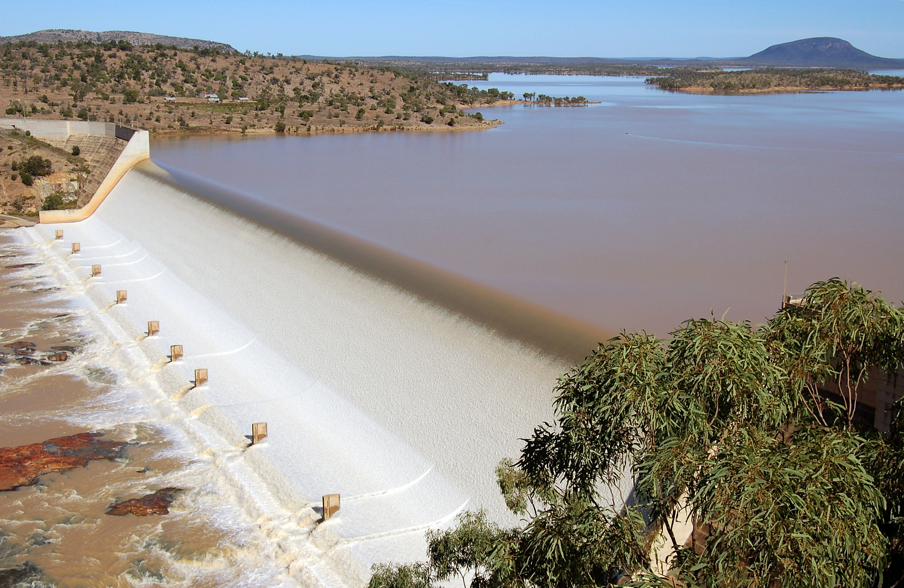
Water levels at Burdekin Falls remain exceptionally high. With current readings at 96.4%, the reservoir holds a robust 1,860 GL. This provides immense water security for the Queensland region.
Catchment & Hydrological Impact
Fed primarily by the Burdekin River, this reservoir plays a critical role in the North East Coast drainage division. Hydrological health in this specific drainage basin is vital for downstream ecosystems. Catchment dynamics in the North East Coast are deeply influenced by the retention capacity of Burdekin Falls.
Agricultural & Economic Significance
Agriculture in the surrounding areas of Queensland depends heavily on the water security provided by Burdekin Falls. The local economy, heavily rooted in agriculture, fluctuates in tandem with the health of this reservoir. Sustainable water management here ensures that both crops and livestock can survive prolonged dry spells.
Ecological & Recreational Context
Ecologically, the reservoir and its immediate wetlands serve as a crucial habitat for native Australian wildlife. During periods of healthy water levels, the area often sees an increase in recreational activities such as fishing, boating, and camping. Authorities must constantly balance the need for human water consumption with the ecological necessity of maintaining healthy river systems downstream.
Current Weather & Evaporation Impact
Current local temperatures are sitting at a moderate 22°C. Under current clear sky weather, there is no direct rainfall contributing to the immediate storage levels.
Future Outlook & Monitoring
Looking ahead, the trajectory of Burdekin Falls's water levels will depend heavily on upcoming seasonal rainfall patterns. State water authorities utilize highly sophisticated monitoring tools to ensure every drop is accounted for. Resilience against extreme weather events remains the ultimate goal for the managers of this critical infrastructure.